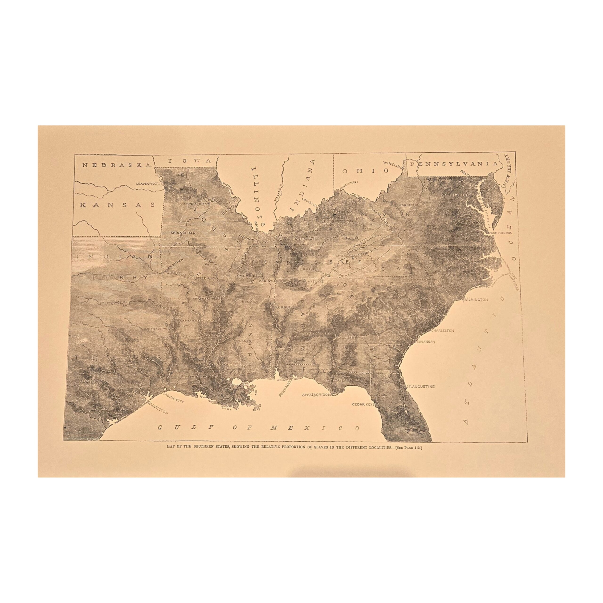
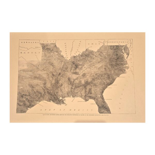
This historical print titled ‘Map of the Southern States Showing the Relative Proportion of Slaves in the Different Localities’ provides a detailed visual representation of slave distribution in the Southern United States during a specific period. It serves as a valuable resource for historical research and analysis.
INDOOR EXHIBIT IS CLOSED


Reviews
There are no reviews yet.